Description
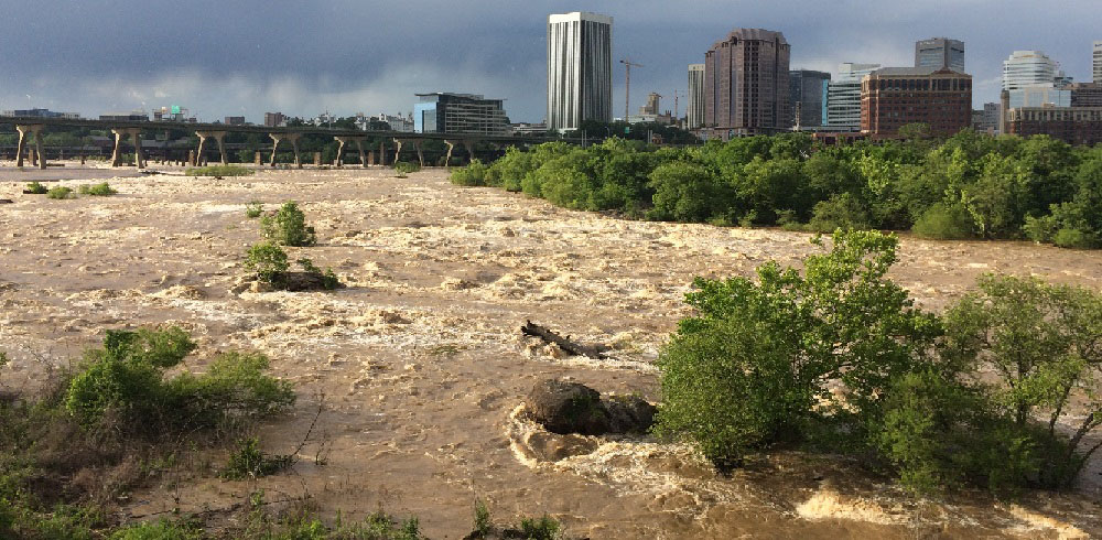
A flood occurs when an area that is normally dry becomes inundated with water. Floods may result from the overflow of surface waters, overflow of inland and tidal waters, dam breaks, or mudflows. Flooding can occur at any time of the year, with peak in the late winter and early spring. Snowmelt and ice jam breakaway contribute to winter flooding; seasonal rain patterns and torrential rains from hurricanes and tropical systems also can contribute to flooding. Development of flood-prone areas usually increases the frequency and degree of flooding.
Flood or Flooding means:
(a) A general and temporary condition of partial or complete inundation of normally dry land areas from:
- (1) The overflow of inland or tidal waters.
- (2) The unusual and rapid accumulation or runoff of surface waters from any source.
- (3) Mudslides (i.e., mudflows) which are proximately caused by flooding as defined in paragraph (a)(2) of this definition and are akin to a river of liquid and flowing mud on the surfaces of normally dry land areas, as when earth is carried by a current of water and deposited along the path of the current.
(Source: Electronic code of federal regulations, Section 59.1 Definitions)
Location and Extent
Low-lying areas in the region are subject to flooding. The occurrence of tropical storms during hurricane season (June - November) are responsible for the more severe flooding experienced in the region. Creek flooding can also occur after locally heavy thunderstorms.
The floodplains of the James River near Lynchburg are developed, containing warehouses, factories, businesses, and the necessary rail, highway, and utility services for the city. Floodplain development for all other streams in the city is mainly residential, with some commercial and industrial sites adjacent to the floodplain areas. In Appomattox County, lower ground along smaller streams is sometimes damaged by flooding of crops, deposition of silt on crops, and by channels silting up and preventing proper drainage.
In Amherst County, Williams Run is much more responsive to localized storms with intense rainfall. The increased development in this area is changing watershed parameters and could cause more severe flooding in the future.
In Bedford County, floodplains usually consist of farmlands and woodlands. Principal concentrations of flood plain development lie along Hunting Creek in the Big Island community, along Mill Creek in the Moneta community, and along Roanoke River, including Smith Mountain Lake and Leesville Lake. Other minor concentrations of commercial and residential structures within flood plains are scattered throughout the county. Low-lying areas of the county are subject to periodic flooding caused by overflow of the following streams: Goose Creek, Big Otter River, and Little Otter River and their tributaries, which drain most of the county and empty into the Roanoke River. James River and its tributaries drain a small area in the northern portion of the county.
In Campbell County, the major portions of the floodplain are located along James and Roanoke (Staunton) Rivers, as well as larger creeks. Low-lying areas adjacent to these waters are subject to periodic flooding. The most severe flooding is usually a result of heavy rains from tropical storms, while, on the smaller creeks, the major floods are the result of local thunderstorms or frontal systems.
History
The CVPDC area has been impacted by a number of flooding events ranging in location, magnitude, and impact. A large percentage of the region’s declared disasters were due to flooding. A table of all the major flood events that have occurred in the CVPDC area is included in the appendix of the hazard mitigation plan document.
Plan Chapter
CVPDC HMP 2020